- Joined
- May 2, 2001
- Messages
- 7,485
2016 Teton Crest Trail
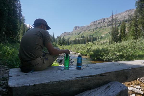
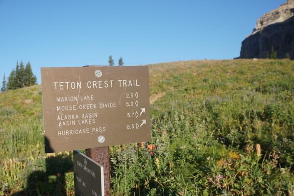
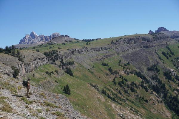
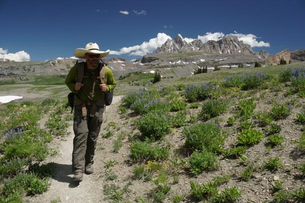
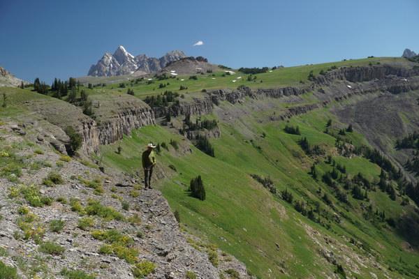
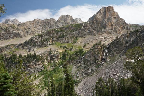
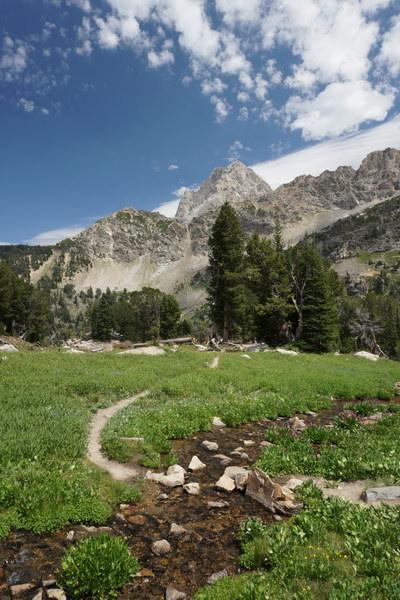
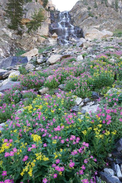
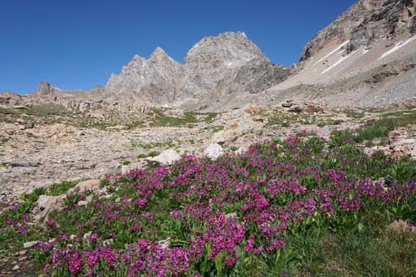
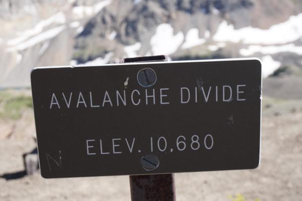
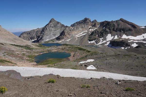
I'd like to share with you the incredibly beautiful experience I had over this past month backpacking Wyoming's Teton Crest Trail. The Teton Crest Trail runs along the top of the alpine areas of Grand Teton National Park. Most of the trail is at altitudes between 9,000 and 10,000 feet. The Teton Crest Trail is considered by many to be the top one or two of trails in the United States.
I covered 85 miles during 3 sessions in a 24 day period.
The past few years I have been writing in the Physical Training For Mountain Hunting And Backpacking sub-forum about my own ways to get in shape for the western mountains hunting season. The key for me has been to admit certain things about myself. The main one is that I would rather pound my thumb with a hammer repeatedly than to exercise indoors on a machine.
So a few years ago I started climbing small 250 foot tall hills in Wisconsin and also upped my biking substantially.The Wisconsin hill climbing naturally led to hiking western mountains in the off season. Rocky Mountain National Park in Colorado and the smaller mountains in Arizona have since become part of my program.
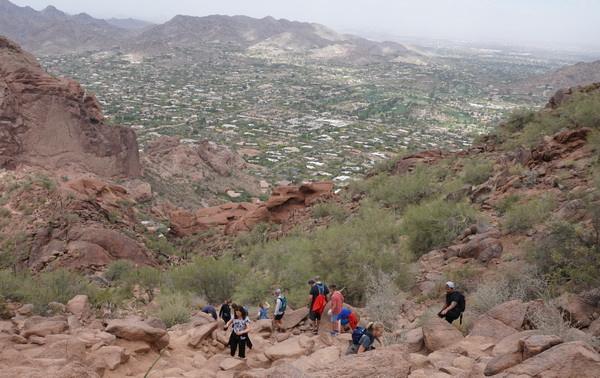
Near Phoenix I again hiked Daisy Mountain repeatedly and also tried Camelback Mountain. That was an interesting challenge. It is a local favorite with heavy traffic to contend with. I ended up concluding that it is so steep with such big "steps" that it takes the fun and motivation away a bit. And it doesn't really duplicate very well or at least very efficiently the rigors of a mountain hunt. So I won't repeat it.
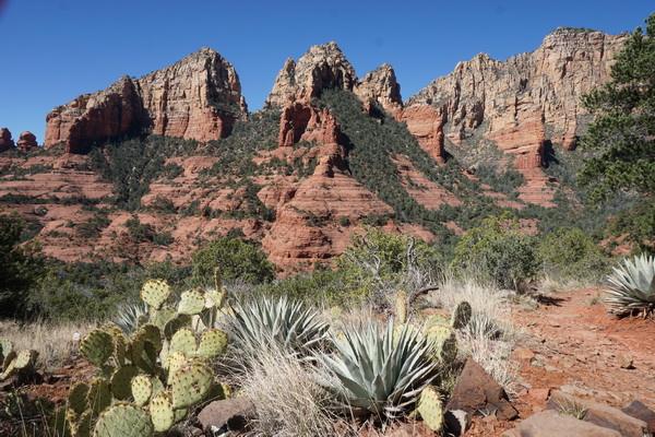
North of Phoenix I discovered the trails around Sedona this last March. Some of the day hikes I did were Wilson Mountain, Bear Mountain and the West Fork of Oak Creek Canyon.

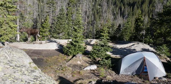
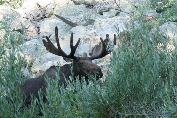
I backpacked 25 miles over two nights in Rocky Mountain National Park back in June of this year. Note the cow moose in my camp on the left in the photo below.
But my most enthusiastic planning for 2016 was for a series of summer backpack trips on and around Wyoming's Teton Crest Trail. I was planning my first trip on the trail to be a solo, 3 night, 4 day, 35 mile route. But when I mentioned to my good friend Robb Wiley of Non-Typical Outfitters that I was heading out in a couple weeks he asked if I would mind if he tagged along.
"No I wouldn't mind at all!" I said. I knew he'd be a great and welcome team member. And I planned to hike the trail a couple more times - in between LRH-NTO Shooting Class sessions. On those trips I could get my fix of solo trekking. So in mid July he and I showed up at the park visitor center about an hour and a half before it opens to stand in line for a back country campsite permit. Being an hour and a half early we were actually number 2 in line that day.
Long story short, we couldn't get the exact combination of sites so we took what we could get and cut the trip down by one day/night and by 5 miles.
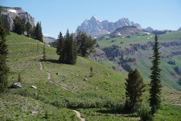
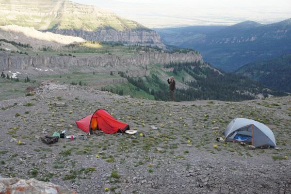
After this first trip I drove home and got ready to come back out just 4 days later for the three sessions of shooting classes. The day after the first class session I was back in line for a camping permit. This time I was solo and repeated one of my favorite parts of the first trip. I set it up so I could camp two consecutive nights in a valley just below the back side of the three Tetons themselves. On the first trip I had identified some amazing photo ops and knew I 'd have to come back during better light and with more of a photography emphasis.
After returning to camp for the second class session Andy was first amused that I was already talking about going back a third time the very next week. Well, he thought about it some more and then asked if he could come along for my third and last time in 2016!
So my third trip along the Teton Crest Trail began.
All in all, I hiked with my mountain "house" on my back for about 85 miles over 3 sessions in a 24 day stretch. It was simply amazing, though I know that word is grossly over-used.
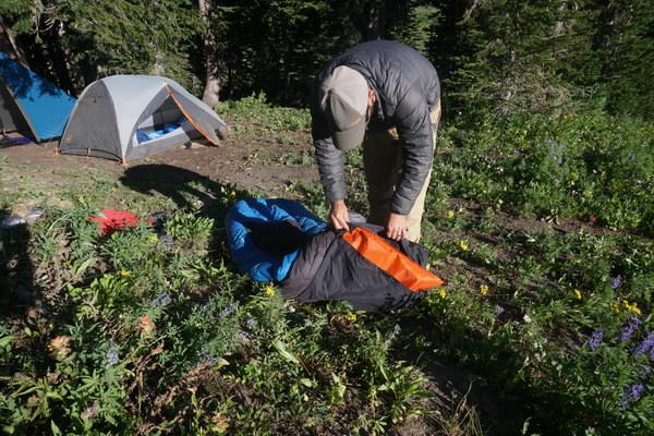
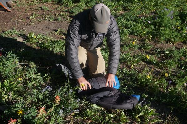
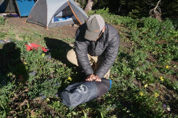
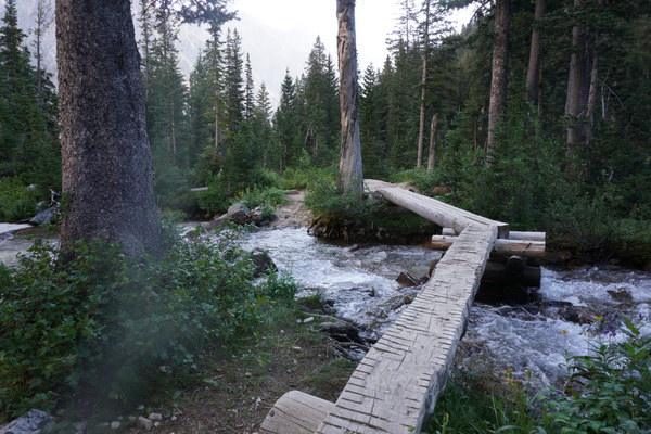
So here are a bunch of my photos from the three trips. There are mixed up a little in sequence but I think you'll get the point nonetheless.
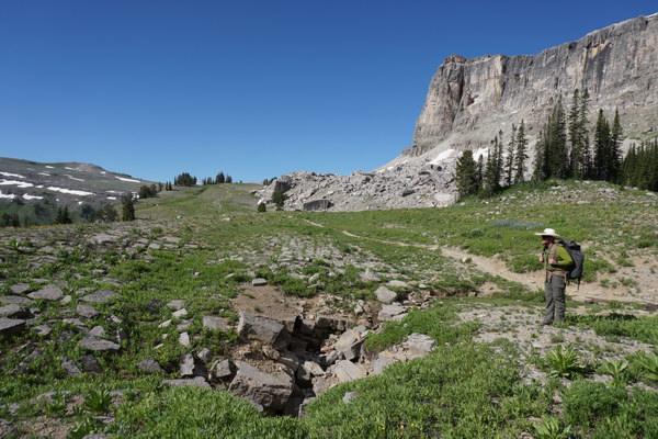
I'd like to share with you the incredibly beautiful experience I had over this past month backpacking Wyoming's Teton Crest Trail. The Teton Crest Trail runs along the top of the alpine areas of Grand Teton National Park. Most of the trail is at altitudes between 9,000 and 10,000 feet. The Teton Crest Trail is considered by many to be the top one or two of trails in the United States.
I covered 85 miles during 3 sessions in a 24 day period.
The past few years I have been writing in the Physical Training For Mountain Hunting And Backpacking sub-forum about my own ways to get in shape for the western mountains hunting season. The key for me has been to admit certain things about myself. The main one is that I would rather pound my thumb with a hammer repeatedly than to exercise indoors on a machine.
So a few years ago I started climbing small 250 foot tall hills in Wisconsin and also upped my biking substantially.The Wisconsin hill climbing naturally led to hiking western mountains in the off season. Rocky Mountain National Park in Colorado and the smaller mountains in Arizona have since become part of my program.
Near Phoenix I again hiked Daisy Mountain repeatedly and also tried Camelback Mountain. That was an interesting challenge. It is a local favorite with heavy traffic to contend with. I ended up concluding that it is so steep with such big "steps" that it takes the fun and motivation away a bit. And it doesn't really duplicate very well or at least very efficiently the rigors of a mountain hunt. So I won't repeat it.
North of Phoenix I discovered the trails around Sedona this last March. Some of the day hikes I did were Wilson Mountain, Bear Mountain and the West Fork of Oak Creek Canyon.
I backpacked 25 miles over two nights in Rocky Mountain National Park back in June of this year. Note the cow moose in my camp on the left in the photo below.
But my most enthusiastic planning for 2016 was for a series of summer backpack trips on and around Wyoming's Teton Crest Trail. I was planning my first trip on the trail to be a solo, 3 night, 4 day, 35 mile route. But when I mentioned to my good friend Robb Wiley of Non-Typical Outfitters that I was heading out in a couple weeks he asked if I would mind if he tagged along.
"No I wouldn't mind at all!" I said. I knew he'd be a great and welcome team member. And I planned to hike the trail a couple more times - in between LRH-NTO Shooting Class sessions. On those trips I could get my fix of solo trekking. So in mid July he and I showed up at the park visitor center about an hour and a half before it opens to stand in line for a back country campsite permit. Being an hour and a half early we were actually number 2 in line that day.
Long story short, we couldn't get the exact combination of sites so we took what we could get and cut the trip down by one day/night and by 5 miles.
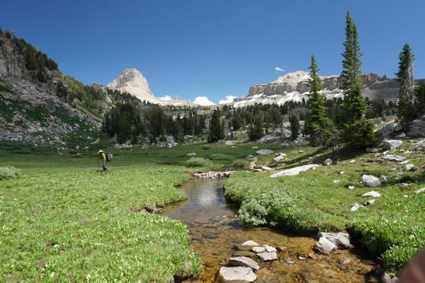
After this first trip I drove home and got ready to come back out just 4 days later for the three sessions of shooting classes. The day after the first class session I was back in line for a camping permit. This time I was solo and repeated one of my favorite parts of the first trip. I set it up so I could camp two consecutive nights in a valley just below the back side of the three Tetons themselves. On the first trip I had identified some amazing photo ops and knew I 'd have to come back during better light and with more of a photography emphasis.
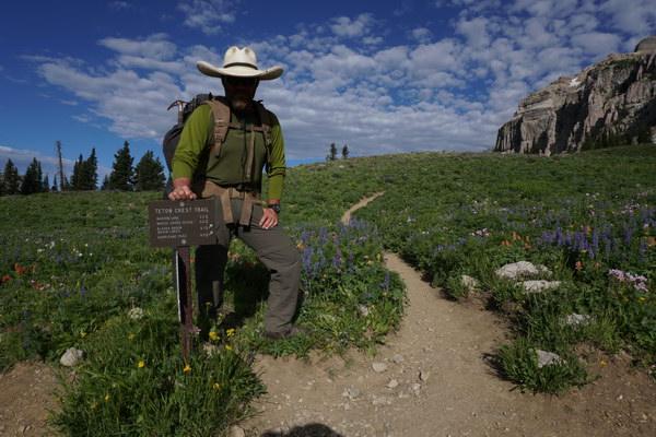
After returning to camp for the second class session Andy was first amused that I was already talking about going back a third time the very next week. Well, he thought about it some more and then asked if he could come along for my third and last time in 2016!
So my third trip along the Teton Crest Trail began.
All in all, I hiked with my mountain "house" on my back for about 85 miles over 3 sessions in a 24 day stretch. It was simply amazing, though I know that word is grossly over-used.
So here are a bunch of my photos from the three trips. There are mixed up a little in sequence but I think you'll get the point nonetheless.
Last edited:

")